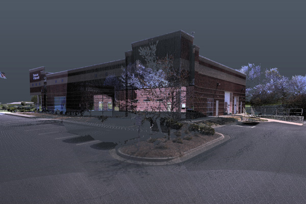
A three-dimensional (3D) representation of an object or space is called a “point cloud” and most often used in the world of architecture, engineering, and construction. It is made of millions of individual data points, each one with an x, y, and z coordinate. Typically, they represent the external surface of an object.
Laser scanning is one of the most common ways to collect the digital data that makes up a point cloud. Photogrammetry in another option to create one.
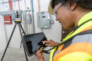
How does a laser scanner capture a point cloud? Laser scanners work by sending out pulses of light to the surface of an object and measuring how long it takes each pulse to reflect and “hit” (or make contact) with the scanner.
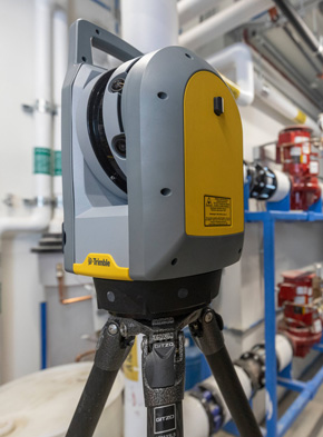
Once collected, the measurements are used to determine the exact position of points on an object. Cushing uses a Trimble X7 laser scanner, and this technology has a lidar sensor which gather millions of precise data points each second.
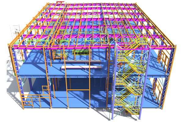
☑ A point cloud paints a comprehensive picture of “as-is” conditions in a building or on a construction site. It collects all the raw spatial data to create a new building information model (BIM) or to update an existing model.
☑ This enables you to compare the existing conditions of a building or structure against the “as-designed” to check for errors, conflicts, and to detect clashes. One of the main benefits is you can quickly identify potential issues that may affect the quality of a building’s performance.

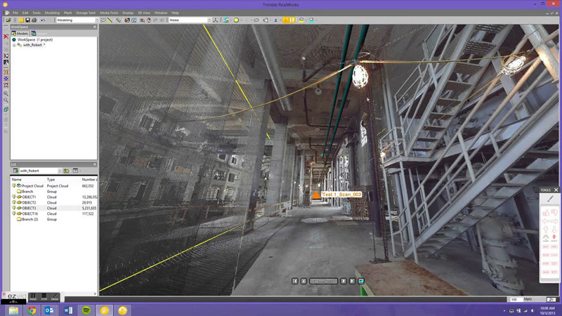
Once a laser scanner gathers data you can create a 3D model based on the coordinates, in your favorite modeling software such as Revit or AutoCAD. This allows you to:
☑ Get a clear overview of the existing conditions on a building site
☑ Identify challenges that will impact design and add to project costs
☑ Detect conflicts or ‘clashes’ from infrastructure such as pipes or electrical
☑ Reduce “rework” on your construction site
This concept of “Scan-to-BIM” continues to gain popularity with engineers, architects, and construction professionals. Cushing provides 3D laser scanning services to capture point clouds for pre-design and or tracking progress on construction sites.
Before you start design on your next project, we can help with scanning your existing project site to identify challenges before they become problems.


Follow Us